

Backpacking to Ostrander Lake in Yosemite
- Liz Masi

- Nov 19, 2025
- 5 min read
This trip was sick. I hands-down recommend it to add to your Yosemite backpacking trip list. My bestie, Chelsie, had permits for this trip and invited me along (Thanks, Chels!) and we had an absolute blast. I am excited to share it with you all!
A quick overview of the trip:
Ostrander Lake from Glacier Point Road is a 12.1 mile out and back trail with approximately 1,800 feet of gain. We did this as a three day, two night trip and did some sidequesting so I think we did about 16 miles total by the end of it.
The lake sits at about 8,500 feet and is evidence of a glacial cirque, which is basically a glacially carved ampitheatre. SO cool.
Here is the All Trails for it: https://www.alltrails.com/trail/us/california/ostrander-lake-trail
Alright, let's get into it. The cool thing about living and working in Yosemite is that you can finish your workday and have access to the most sought after trails in the country right out of your door. That is not lost on me.
So, after a nice work week, Chels and I hopped in her car and headed 45 minutes up to the Ostrander Lake trailhead on Glacier Point road. We switched from our car shoes to our trail shoes, did a last second shakeout. I realized I did not need two pairs of sunglasses, for instance, and then we hit the trail!

The first two-ish miles of the trail are cruiser through meadows and old burn scars. We did this in July 2025, the wildflowers were immediately popping, and it was just the beginning of what floral delights we would see!
After mile two is when the climbing began through a very intensely burned area, this was both cool and creepy. I would not hike through this section on a windy day.


As you climbed up through this section, you really saw the expanse of the fire. What was once a cool (and overcrowded) forest is now a hot, brushy, exposed landscape.
The next notable section, I do not have a picture of. It was almost a .75 mile of overgrown brush that you have to push through. I mildly regretted my choice of hiking skirt, but my sweaty legs did a nice job of gliding through the shubbery. TMI? Lol.
All of my thorns in my skin were washed away when we got to the next section. LUPINE HEAVEN! Oh my gosh. The setting sun caught the Lupine's just right. Chelsie and I took a nice break here admiring the beautiful purple flowers that bounced off the burned landscape. Just gorgeous.


The next section before "Heart Attack Hill" was a nice, sustained climb. What I enjoyed about it was that you started to have perview to the High Sierras and pointing out peaks is always fun.
Another fun thing on the hike in was determining what spot actually was "Heart Attack Hill". We found it for sure. We also found something else on this hill. A group of hikers that were so wildly unprepared that it was actually impressive. Mind you, we are roughly 5 miles into this trail, and a dude is carrying a cast iron camping stove.
This photo is from the way out but it was truly impressive to see that people were carrying this 12 miles round trip into the backcountry.
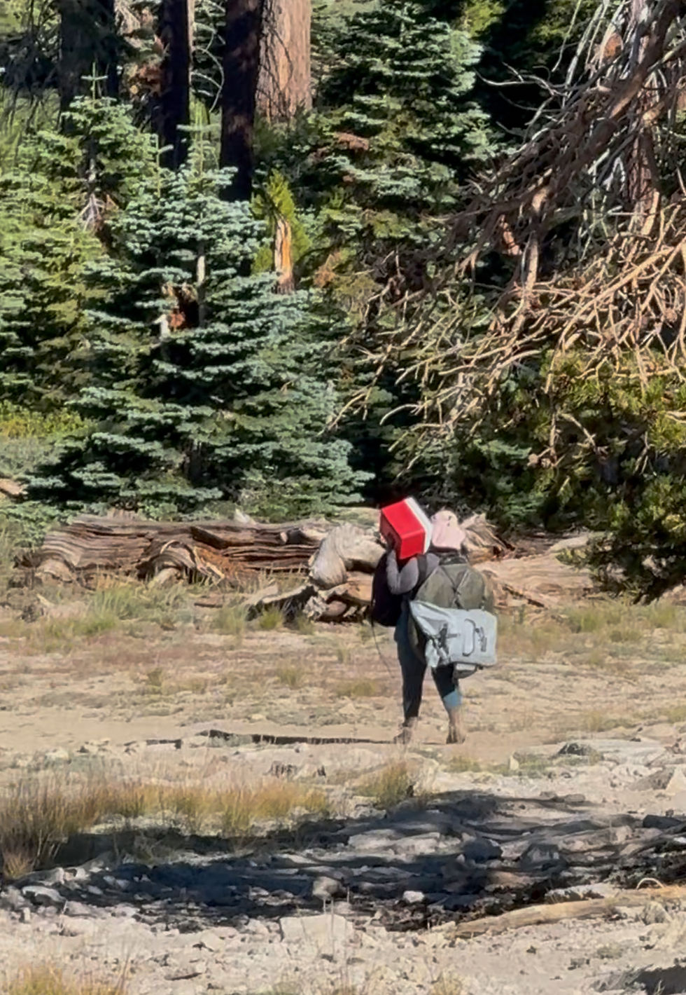
I am super for the new outdoor adventurer. But what was upsetting about this scenario was a blatant disregard for the Leave No Trace principles and Bear Safety in the Yosemite Wilderness. Okay, enough of that soap box.
Chels and I cruised into camp after Heart Attack Hill. The last mile was a fun cat & mouse of "Where's the Lake?". You basically skirt around a ridge and drop into it!


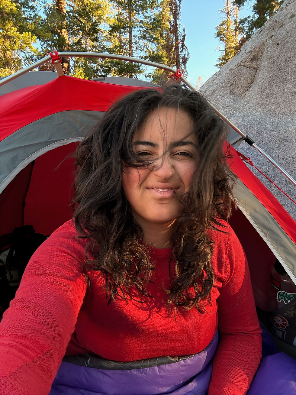
We made camp for the night quickly around other backpackers and decided we would move spots the next day if needed. I slept really well, but poor Chelsie was kept up by the aforementioned group all night. It's okay though, morning coffee made up for it!
The next morning, we explored deeper into the backpackers camp. We had nothing but time, so we deliberated many different spots and ranked them based on flatness and scary trees. We finally found the perfect spot tucked in the back of the lake. It was nice and quiet and had good lake access within a 100 foot walk (follow the rules on your permit!).

After we got set up, we explored to find the "elusive" Hart Lakes. I say this because well, it took us about two hours to find as we were following the skiers trail. Then I had a realization, the skiers trail is...meant to be skiied. So we basically hiked up and past and down and in to Hart Lakes when in reality- it was about twenty minutes uphill from Ostrander. That was okay though, the views were great and bushwhacking is always an adventure.

When we got back from this, I'll call it, expedition. We cooled off in the lake and I used my big brain by inflating my sleeping pad to make an impromptu floatie!

Chels and I had a super chill afternoon which ebbed between reading our books (I read the American class, The Virgin Suicides), journaling, napping, exploring the area, and chatting. You can't beat the slowness of the backcountry - I'll tell you that.


As sunset moved in, we ate dinner and crawled into our respective tents. The wind really picked up which is always tough when backpacking, but otherwise I slept well.

Chels and I enjoyed our morning treats and packed up camp. We both agreed on an earlyish start so we could get home for Sunday resets. I have a hard date with a Sunday nap on the couch with the dogs.
The hike out was great, and we took the time to notice even more flowers!


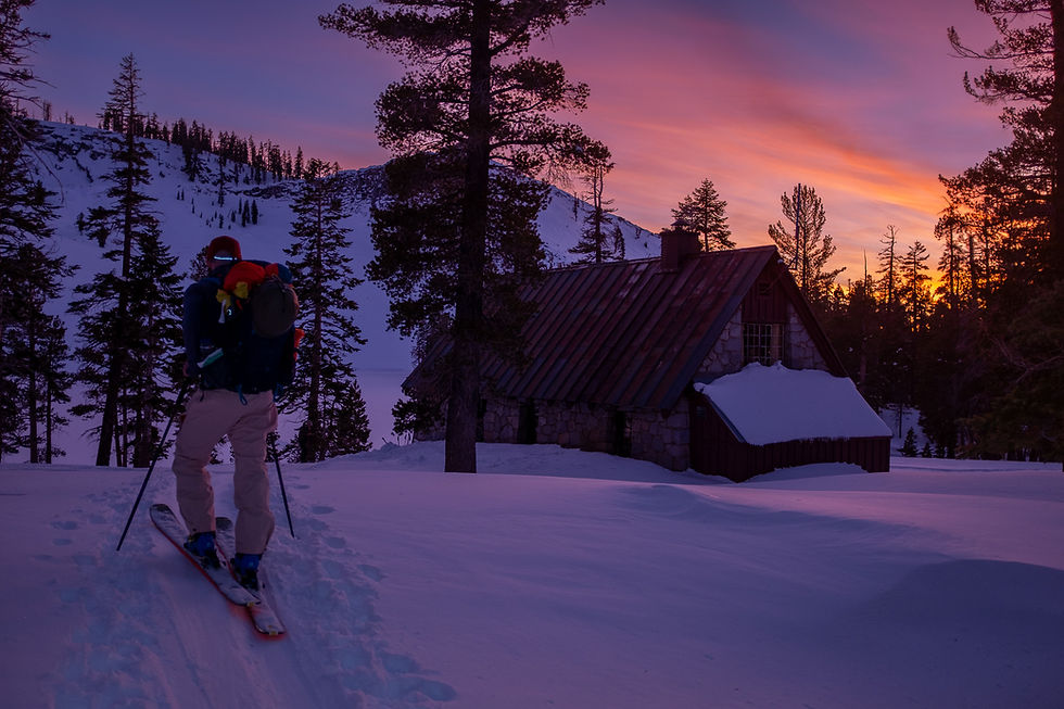
I cannot recommend the Ostrander Lakes trip enough. It will definitely be a repeat trip for me. The sunsets are gorgeous, the ski hut is incredible to see in person espescially thinking about how the materials got there, and the lake is a great place to hangout.
My only "regret" was not bringing my watercolors! Until next time....
Thank you for reading, would love to hear what you thought about it in the comments!


Comments